
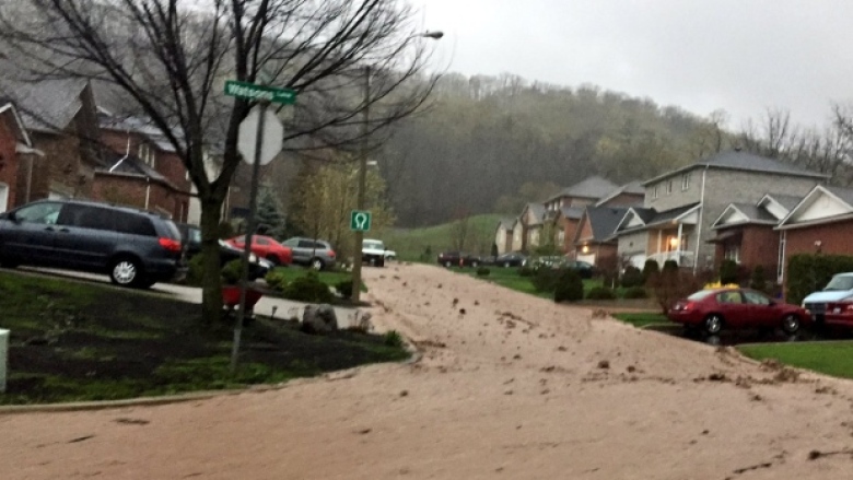
A car sits stranded in flood waters on Rue Saint-Louis in Gatineau on Tuesday, May 2. (Radio-Canada)
Here Paul was picked up by CBC Television, and has an associated podcast clip (about six minutes long) which they shared with him, and likely more to follow tomorrow, possibly nationally. There are several parts to this, and all dovetail. Simply shared thus:
“Gatineau flooding ‘tip of the iceberg,’ climate scientist warns.
And “Region received more than 3 times normal rainfall for April”.
From CBC Radio’s Ottawa Morning · CBC News, 10 Hours Ago:
“As water levels continue to rise in the national capital region, a climate scientist is warning flooding and extreme weather events are here to stay, and says homeowners should prepare.
Swollen rivers and streams have threatened hundreds of homes in the Outaouais thanks to recent heavy rainfall — three times the normal amount since April 1.
University of Ottawa climate scientist Paul Beckwith says that’s due to a changing climate, and says we’re seeing its effects “on a day-to-day basis” in weather patterns.
“What we can see is that the jet streams are behaving differently. They’re much slower, wavier, and storms are therefore moving slower. So when they’re carrying water, they’re hovering over an area longer than they would be normally, so they’re depositing more water,” Beckwith told host Hallie Cotnam on CBC Radio’s Ottawa Morning.
“Normally you think of climate change as being something that’s happening over 20 or 30 years. But what we’re seeing is the conditions on the planet are changing rapidly. So the arctic is a lot warmer than it used to be, so that’s throwing off the heat balance on the whole planet.”

‘Tip of the iceberg‘
Beckwith points to an increase in extreme weather events across North America as proof. “We’ve changed the chemistry of the atmosphere and the oceans with our greenhouse gases, so we’re seeing the consequences of this now,” he added. “It’s only the tip of the iceberg, so to speak.”
Paul Beckwith is a climate scientist with the University of Ottawa. (CBC)
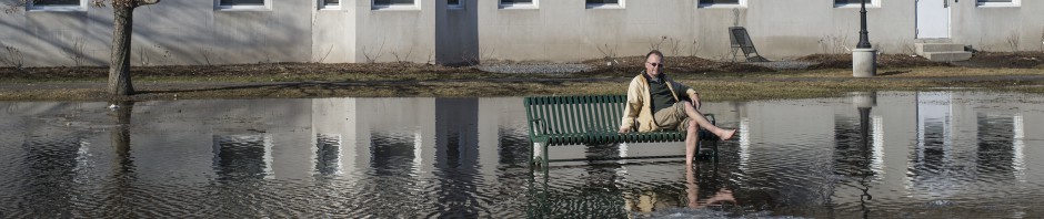
Voluntary evacuations and road closures have been underway in Gatineau and other west Quebec municipalities this week due to floods. As flood water creeps closer to homes, Beckwith warns this could become more regular occurrence for people who live near rivers or in low-lying areas.
“I think in the very near future, the elevation of a house will be on the MLS [real estate] system,” he said. “So when you buy a house, you’ll know the local elevation. So houses that are on higher ground will command higher prices. Houses on lower ground — if you flood now, you’re going to flood in the future.”

“…It’s just a matter of time before it happens to just about any city the way climate change is accelerating.”
———- ———-
Despite a day of sandbagging, Ward’s Island residents may still need to evacuate.
Ferry will be kept overnight on standby at Ward’s Dock for ‘after-hours storm and temporary shelter’.
‘With Lake Ontario at its highest point in decades and with heavy rain already falling, the City of Toronto is preparing for a possible evacuation of Toronto Island Park. But its residents have spent the day laying sandbags around low-lying areas in the hope they can stay in their homes. Between 40 and 90 millimetres of rain could fall on Toronto between Thursday evening and Saturday, according to Environment Canada — a figure the weather agency increased after the storm began. Article continues in full, here.
———- ———-
Shoreline and flood worries as wind and rain hit Hamilton and region.
High water levels may lead to some shoreline flooding and beach erosion.
A flood watch is in effect for Hamilton as the city and much of southern Ontario brace for several more days of rain.
The Hamilton Conservation Authority (HCA) says this forecasted rainfall may result in further increases in water levels and flows in area watercourses, with the potential for significant flooding.
There is further concern about the potential impacts of northerly winds on the shores of Lake Ontario. Those winds may increase the risk of shoreline flooding and erosion, with Lake Ontario levels already high.
The latest rainfall — from Thursday through to Saturday — comes on top of records numbers for the year so far.
“This has been a record rainy first 125 days of a year, never has there been so much rain in that period in the Hamilton area,” said Dave Phillips, Environment Canada. Phillips says Hamilton has received about 87 per cent more rain than the city would normally get so far this year. Article continues in full, here.
——— ———-
To Flood or Not to Flood; Assess YOUR Risks
Published on May 4, 2017
I teach you the basics of how to assess your personal risk of being flooded out of your place, either from nearby river or ocean rise or overland flooding with torrential rains.
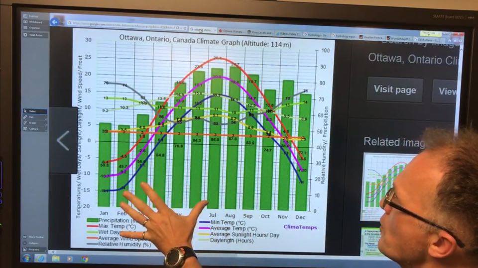
There are some basic easy-to-use tools on the web that will let you figure out your risks. These include climographs of your region, local weather forecasts, stream and river flow gauges and forecasts, DEM (Digital Elevation Models) or detailed maps of hills and valleys in your region, types of soils, and historical data on flood occurrences, etc.

